Data Bases
The Quebec Railways Historical Research Institute has data bases which are sufficiently developed to fulfill our mission. Our data bases contain the following elements:
- Cartographic data bases of railways in Quebec
- Cartographic data bases of post offices in Quebec
- Historical maps
- Research documents
- Timetables
- Library
- Periodicals and magazines
- Historical pictures
Cartographic data bases of railways in Quebec
The cartographic computerized data bases are built on the scale of 1: 50 000. They show in a historical perspective, all the railways with their junctions, sidetracks, stations, and railway places, as well as the names used during the course of the years, the year of construction and the interruption of service.
To constitute these cartographic data bases, we have pulled together all the resources which form the main data bases. So, from ancient documents, we have mapped the localisation of railway lines with their different associated place names. With the help of other ancient cartographic sources (ex. regional maps), we have been able to validate different information. In more complex cases, we have used aerial photographs of different eras. In short, we have consulted more than 1500 maps to complete these data bases.
For Example :
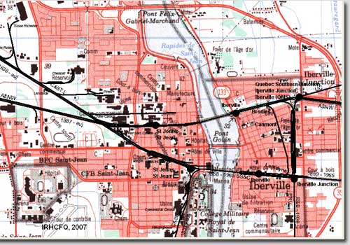
Saint-Jean-sur-Richelieu
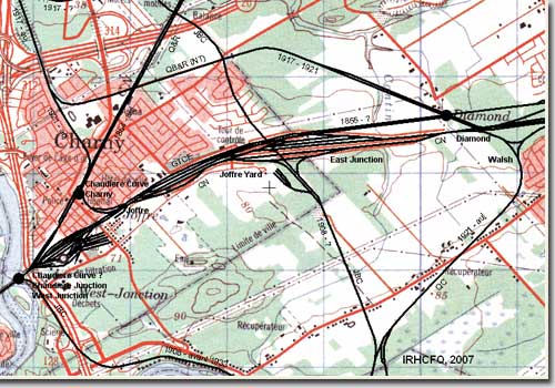
Charny
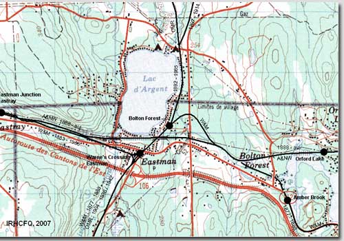
Eastman
Cartographic data bases of post offices in Quebec
The postal history is directly linked to the railway system which was used to transport the mail. In this context, we have constituted cartographic computerized data to the scale of 1: 50 000, giving place names and the post office localisations which were current in the territory of Quebec from 1763 to 1986. We often produced maps to the scale of 1: 250 000 in order to better illustrate these data bases.
We have used the same topographical maps which served to create the railway data bases as well as the Canadian Postal Archives and the post offices repertory of Quebec published by the Société d’histoire postale du Québec (Postal History Society of Quebec).
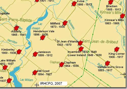
Example: Map to the scale of 1:250 000, post offices of the region between Lyster and Thetford Mines
Historical maps
The archives of the IRHCFQ have some 600 duplications of maps and historic plans, including a series of former topographic maps (1909 - 1960) covering Quebec. Our archives also consist of many regional maps dating from the end of 19th century to the beginning of the 20th century. Municipal and Insurance Company maps were also a good source of information.
Exemple:
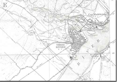
Topographical map to the scale of 1: 63 360, 31 I 7, Trois-Rivières, 1924, National Defence Canada.
Research documents
To achieve its works, the IRHCFQ has constituted archival records on the Quebec railway history, comprised of 2.5 linear metres. These records also include a file by railway lines. Theses files are composed of articles from specialized magazines; principally, we have all that was published in the famous periodical "Canadian Rail" concerning Quebec. We also have on file extracts of municipal monographs, extracts of maps, copies of photographs and of documents from consulted archives, etc.
The IRHCFQ has made different informative data bases for referential ends. We also find a historic file on each railway line/company, comprised of the owners and operators list, important evolution dates of each railway and the main events that contributed to its creation, development, or its abandonment. One equally finds railway place names of Quebec. This index permits us to mark out the historical bounds of each place name that one finds on the cartographic railways data bases.
We have also attached a few examples of research documents and extracts of our archive assets.
Extract of the Index of railway place names of Quebec
Example of document archive:
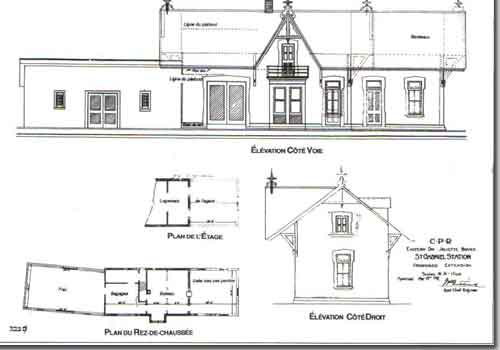
Archives of the CP: Plan of the St. Gabriel Station.
Timetables
The IRHCFQ has acquired a series of ancient timetables of the railways in Quebec.The employee’s timetables are documents which contain pertinent information relative to the activitiesof the railways. So, in order to mark out the place name of the railway, we have used the timetables of numerous passenger trains.The following example is self-explanatory.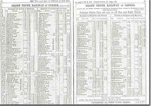
Timetable exemple : Grand Trunk Ry. 1872, Canadian National Ry. 1941,
Library
The IRHCFQ has accumulated many books dealing in full or in part with Quebec and Canadian railways. Although works treating specifically of Quebec are few, the library now has a little more than 175 titles. The library also has at least 35 videos. You could consult the bibliography below.Bibliographical inventory of the IRHCFQ
Periodicals and magazines
The Institute owns a number of periodicals and magazines on the history of Canadian railways (Canadian Rail, TRAQ, Branchline, CN Lines, Le Rail Miniature, etc.). One can find the complete collection of “Le Rail Miniature”, a French Quebec periodical which was published between 1988 and 1998.Example: Magazine cover with link
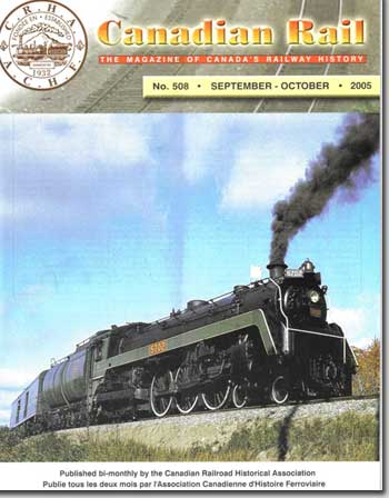
Canadian Rail (Click on image and go to exporail.org)
Historical pictures
The IRHCFQ have a collection of 1200 scanned photographs presenting different aspects of the railway system (train wrecks, landscapes, train stations, rolling stocks, etc.). This data base of old pictures grows constantly; thanks to the collaboration and gifts from historical railway buffs. We invite you to do the same and share your findings with us.You will find a few samples of these photographic data bases.
Photo description
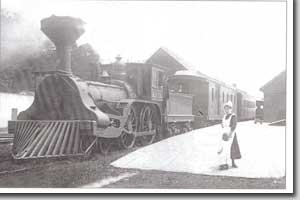
Carillon & Grenville RR, around 1905, 5’6’’ gauge. Post card. Unknow source.
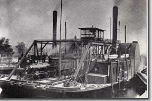
Canada Atlantic Ry. Ferry at Coteau Landing, 1890. From Railroads of Canada, Robert F. Legget, p. 35.

Ice Railway between Montreal and Longueuil (QMO&O), 1880 (1880-83). From Railway Country, D. Witney et B. D.Johnson, Keyporter Books, p. 60.
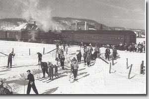
Ski Train at St. Sauveur (CN), around 1939. Post card from Canadian National Archives.
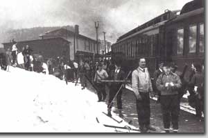
Snow Train at Ste. Marguerite (CP). Photo CP Archives, neg 24196.
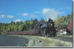
Excursion Train at Blue Sea Lake (CP), October 4 1981. Photo Ted Wickson, JBC Visuals post card.
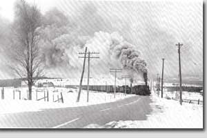
Winter scenery between Megantic and Scostown, 1957. Photo Jim Shaughnessy, from Canadian Pacific in the East vol. 2, Omer Lavallée, p.8.
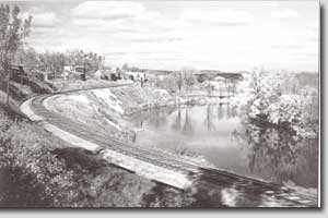
Near l’Annonciation (CP). Photo Michel Photo, coll. Jean-Pierre Bourbeau, from Les Laurentides - La belle randonnée, Jean-Pierre Bourbeau, Ed. GID, 2005, p.161.
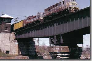
Canal Lachine Tower (CP), train 908, May 1971. Photo Stan Smaill, from CP in Color Vol. 1, Bill Linley, Morning Sun Books, 2003, p. 67.
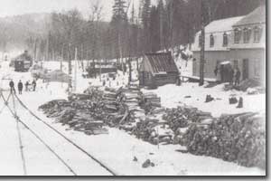
Winter Scenery on the Quebec & Lake St. John Ry., around 1885. National Archives of Canada ANC-16 (63218)-B.
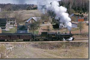
Mix Train 302 and Loco 2541 leaving St. Gabriel de Brandon (CP), March 18, 1957. Photo Fred Angus, JBC Visuals post card.
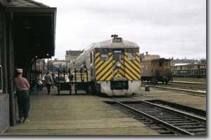
Train 203, RDC2 9112, Megantic Station (CP). Photo Herman Shaner, from CP in Color Vol. 1, Bill Linley, Morning Sun Books, 2003, p. 37.
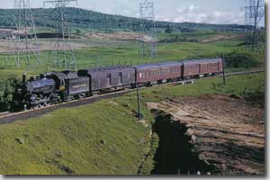
Train 382 near Les Grès (CP), May 1953. Photo Omer Lavallée, from CP in Color Vol. 1, Bill Linley, Morning Sun Books, 2003, p. 55.
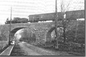
Viaduc Upper Lachine Rd. (CP), around 1890. Photo CP Archives. From Canadian Pacific on the East Vol. 2, Omer Lavallée, 1989, p.14.
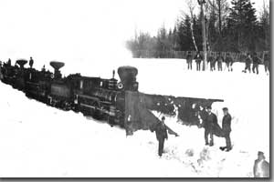
Snow removal at Chaudiere (GT), February 1869. Photo Alexander Henderson, National Archives of Canada PA-149764.
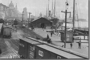
Port of Montreal (GT), 1880. National Archives of Canada C73278.
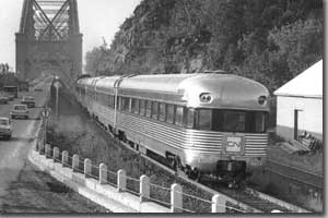
Train “Champlain” near the Quebec Bridge, august 1964. Photo Jim Shaughnessy, from Canadian National Railway, Tom Murray, Ed. MBI, p.99.
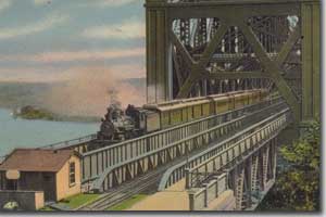
Quebec Bridge (QB&R). Post card, collection BANQ CP3245.
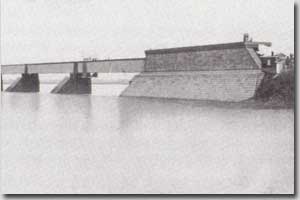
First Victoria Bridge (GT), tubular structure. From Illustrated history of Canadian railways, Nick & Helma Mika and Donald M.Wilson, Ed Mika, 1986, p. 57.
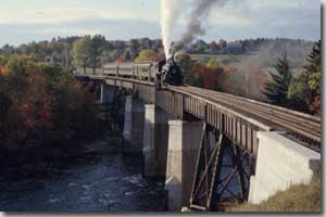
Rawdon Bridge and CRHA Excursion Train, October 2, 1955. Photo Doug Brown, from Web Site of Glenn F. Cartwright: View of Rawdon Train.
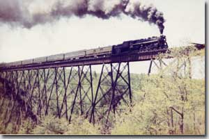
Ste. Ursule Bridge (CN). Unknown source.
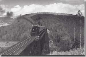
Trestle over the Milieu River (CN), 1951. Photo Canadian National Archives, from Canadian National in the East Vol. 3, J. Norman Lowe, 1985, p.21.
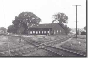
Waterloo Roundhouse and CN – CP Junction, 1957. Photo Omer Lavallée.
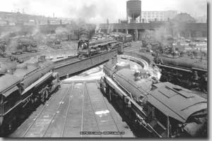
Turcot Roundhouse (CN), 1943. CN Collection, Canada Science and Technology Museum.
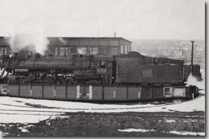
Turntable and loco 4314 at Monk (CN). CN Collection, Canada Science and Technology Musuem.
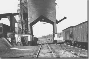
Coal Tower at Monk (CN). CN Collection, Canada Science and Technology Musuem.
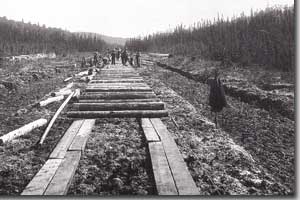
Construction of Q&LSJ La Tuque Branch, 1907. From Railway Country, D. Witney and B. D. Johnson, Keyporter Books, p. 61.
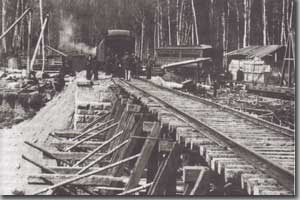
Construction of Northern Colonization Railway (CP) near Mont-Laurier, around 1909. From Un diocese dans les cantons du Nord, Luc Coursol, p. 23.
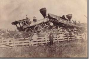
Wreck on South Eastern Railway, near Waterloo, June 26, 1879. IRHCFQ numerical collection.
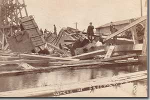
Collapse of Eastman Bridge (CP), November 1, 1907. IRHCFQ numerical collection.
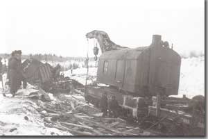
Derail Train at Lac Saguay (CP), winter 1947. Photo Collection Société d’histoire de Mont-Laurier.
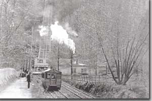
Montreal Incline Railway, around 1890-95. Collection Marcel Paquette.
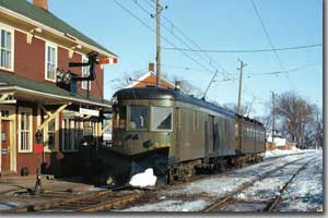
Montreal & Southern Counties Railway at Marieville Station, 1955. Unknow source.
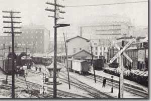
QRL&P St. Paul Street Quebec Terminal, 1918. Unknow source.
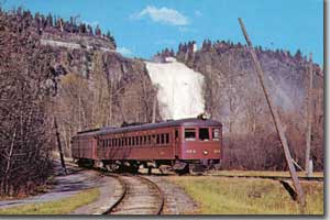
QRL&P Montmorency Falls “Y”, November 1950. Photo Omer Lavallée, JBC Visuals post card.
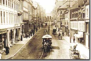
St. John’s Street Ry. Tramway, horsedrawn, around 1900. From postcard # 126 Reflets d’ici.
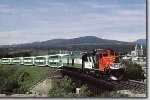
Tourist Train “Le Tortillard du Saint-Laurent” at Beaupré, 1984. Photo Ted Wickson, JBC Visuals postcard.
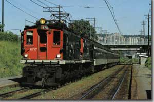
Commuter Train 911 at Mont-Royal (CN), 1991. Unknow source.
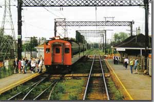
Commuter Train at Val-Royal (CN), around 1944. Photo Marc Dufour, from Connaissance du Rail # 169, mai 1995.
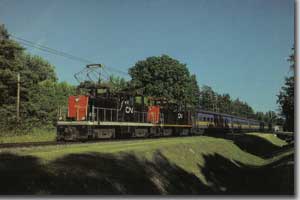
Commuter Train at Laval Links (CN), July 2, 1991. Photo Ted Wickson, JBC Visuals postcard.
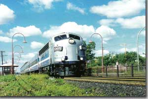
Commuter Train and loco 1305 leaving Pine Beach Station (CP), around 1994. Photo A. Gorin.
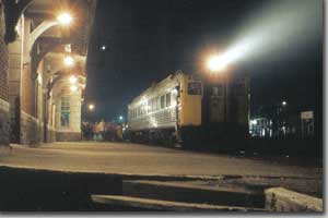
The last VIA 171 Train at Lachute (CP), November 14, 1981. Photo Ian Walker, from Branchline Magazine, November 2006, p. 21.
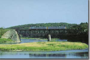
Train VIA 629 sur le pont de Richmond (CN), 1985. Photo Bill Linley, carte postale JBC Visuals.
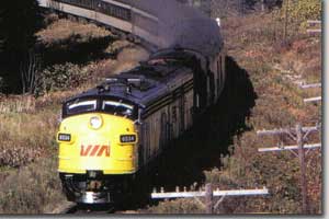
Train VIA 629 on Richmond Bridge (CN), 1985. Photo Bill Linley, JBC Visuals postcard.


